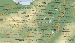
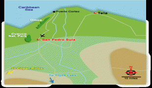
San Pedro Sula (San Pedro Sula)
 |
 |
Before the arrival of the Spanish, the Sula Valley was home to approximately 50,000 native inhabitants. The area that is home to the modern city served as a local trade hub for the Mayan and Aztec civilizations. The Spanish conquest brought about a demographic collapse from which the native population would never recover.
On 27 June 1536, Don Pedro de Alvarado founded a Spanish town beside the Indian settlement of Choloma, with the name of Villa de Señor San Pedro de Puerto Caballos (modern San Pedro Sula). The new town had 35 Spanish citizens, and Alvarado allocated 200 of his slaves to help build the new town and work the surrounding fields. He sent out expeditions into outlying regions to secure the new town, extend the area of Spanish domination, and commandeer supplies. Alvarado annulled all encomienda rights established in the area under Andres de Cerezeda, and reassigned the villages to the citizens of San Pedro.
The new settlement barely survived the colonial period. In 1601, the Spanish government declared Santo Tomás as the official port for the Central American colonies; this move diverted exports from Puerto Cortés and resulted in an economic decline that would last through the 17th century. Additionally, San Pedro Sula was left exposed to raids by pirates and French, Dutch, and English mercenaries. By the mid-18th century, the Spanish government decided to build a number of coastal fortresses to curb English attacks. One of these fortresses, the Fortaleza de San Fernando, was built in Omoa, less than 50 miles from San Pedro Sula. The subsequent increase in trade supported an increase in population from 70 inhabitants in 1714 to 357 in 1789.
Post-independence San Pedro Sula remained an impoverished village, dependent on trade between Omoa and the country's interior. In 1875, Frank Frye, the American consul in the Bay Islands, reported a population of 1200. The city benefitted from the growth of the banana trade in the 1870s and 1880s and formed a close relationship with US-based shipper and railroad entrepreneur Samuel Zemurray's Cuyamel Fruit Company, and the construction of the Interoceanic Railroad between 1869 and 1874 which connected the city to the coast at Puerto Cortés. Zemurray worked closely with local elites who invested in subsidiary enterprises and thus shaped the way politically for Cuyamel to establish itself and pay very few taxes.
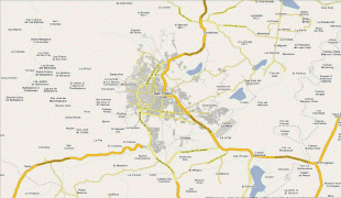
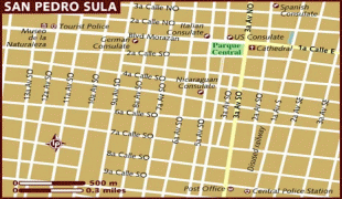
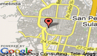
Map - San Pedro Sula (San Pedro Sula)
Map


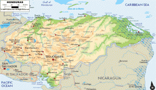


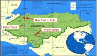
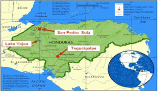


Country - Honduras
 |
 |
| Flag of Honduras | |
Honduras was home to several important Mesoamerican cultures, most notably the Maya, before the Spanish colonization in the sixteenth century. The Spanish introduced Catholicism and the now predominant Spanish language, along with numerous customs that have blended with the indigenous culture. Honduras became independent in 1821 and has since been a republic, although it has consistently endured much social strife and political instability, and remains one of the poorest countries in the Western Hemisphere. In 1960, the northern part of what was the Mosquito Coast was transferred from Nicaragua to Honduras by the International Court of Justice.
Currency / Language
| ISO | Currency | Symbol | Significant figures |
|---|---|---|---|
| HNL | Honduran lempira | L | 2 |
| ISO | Language |
|---|---|
| ES | Spanish language |